Mee Canyon Alcove: The largest alcove on the Colorado Plateau
Mee Canyon Alcove is located on the western slope of Colorado. It is the largest naturally occurring alcove on the entire Colorado Plateau. This hike takes you down into Mee Canyon for spectacular views of this massive alcove. This route is not for those that have a fear of heights as you will be working your way down a canyon and there is a narrow rock ledge that must be traversed in order to reach the bottom of the canyon. The trail is also all downhill to the alcove, so keep in mind it will be all uphill on the way back out.
This post contains affiliate links. If you make a purchase through one of these links, I may receive compensation at no extra cost to you. Thank you for your support.
Hiking Mee Canyon Alcove
Hiking to Mee Canyon Alcove is an exhilarating experience with many highlights on your way to the alcove. From the onset of the hike, you begin hiking gradually downhill with views of McInnis Canyon’s National Conservation Area ahead of you. As you hike through this stretch you will likely see signs left behind from wintering elk all over the place. After approximately 1.8 miles, you begin working your way into Mee Canyon.
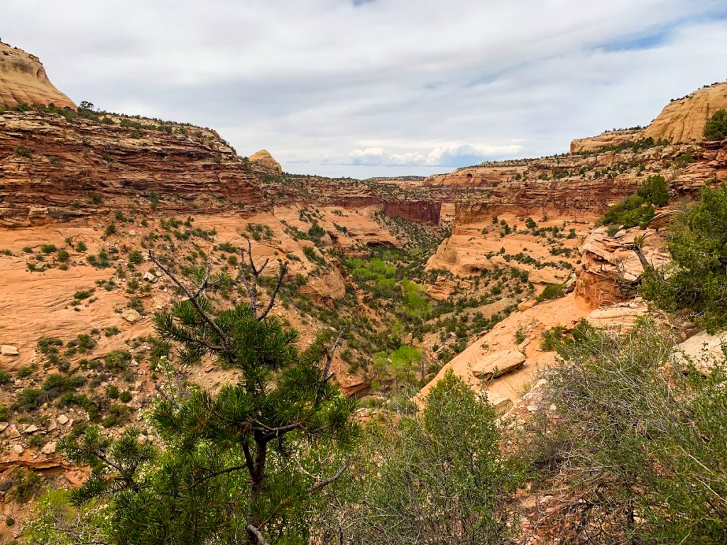
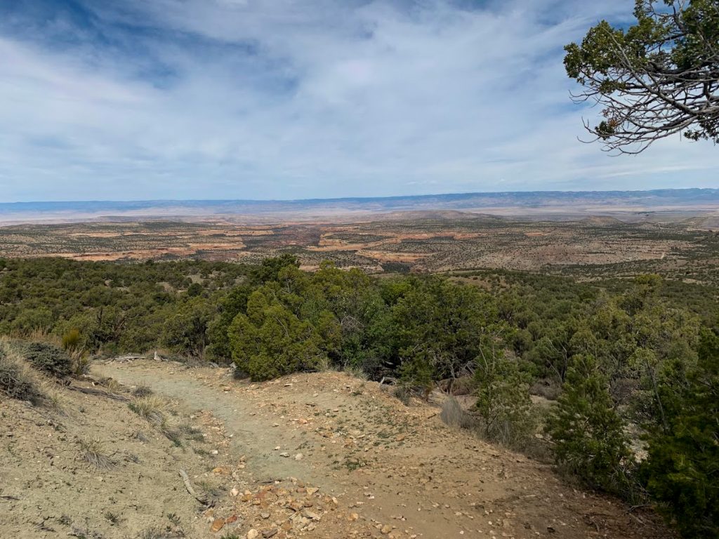 Views of the distant canyons as you begin your hike
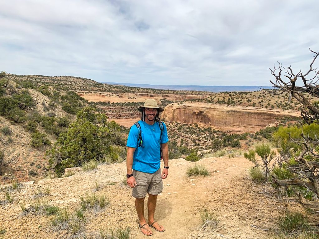 Standing at the top of Mee Canyon before beginning the descent into the canyon
You first drop down off a rock shelf to begin your descent. Look for a small tree that helps you lower yourself down this shelf. Next, you will crouch through a small arch and descend a primitive style ladder deeper into the canyon. After the ladder, there is another descent down some rock ledges and some slickrock before you reach a flat bench.
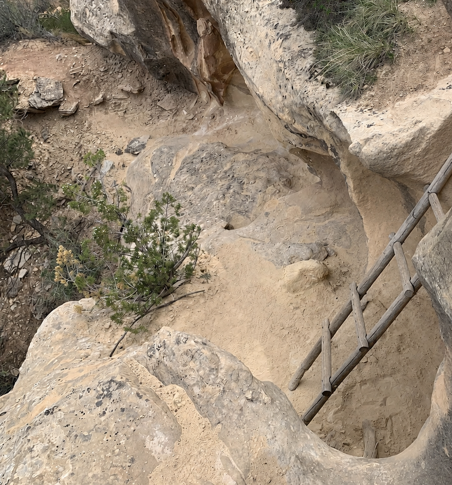
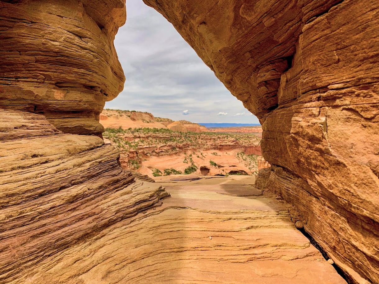
This bench leads you to the upper portion of the main canyon. As you travel along the bench, you will reach a spot where it looks like the trail disappears and there is nothing but a cliff in front of you. At this point, you need to look up and scramble up this rock face. Here, you will find a rock window that you need to climb through to continue on the trail.
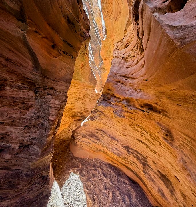
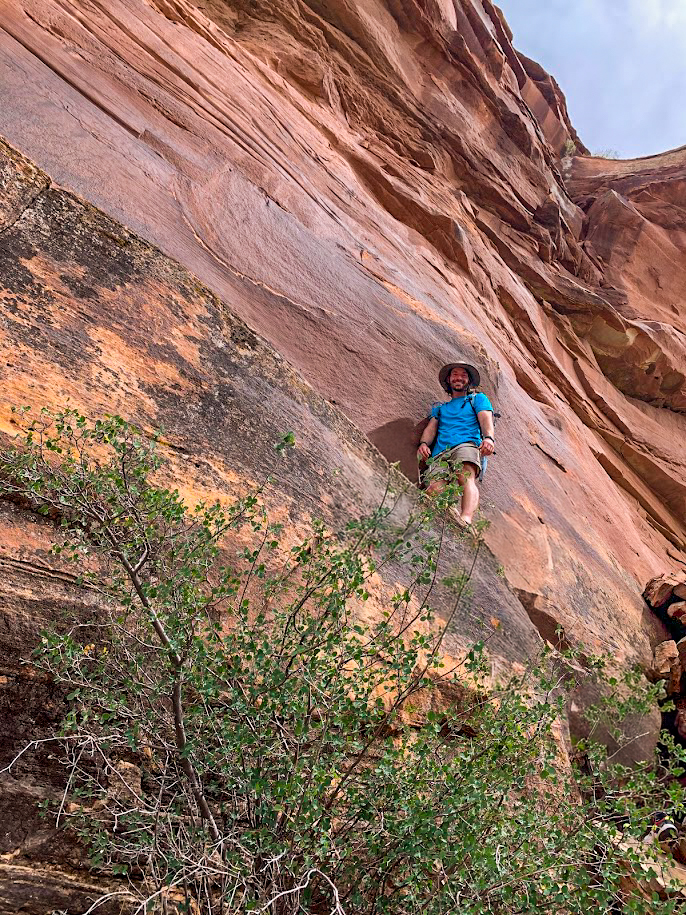
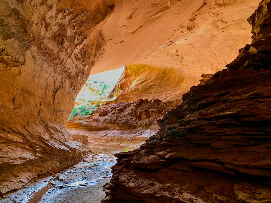
After the rock window, you continue following rock cairns deeper into the canyon and descending down rock faces and benches. As you near the canyon floor, you have to traverse a narrow rock ledge for about 20 feet. The ledge is around 18-inches wide and is roughly 20 feet in the air from the rocks below, so it is definitely a little daunting. Take your time and be sure of your footing before proceeding. At the end of the ledge, there is a drop off from the ledge that is a little difficult to navigate. Again, take your time and use your arms and legs to scramble down this stretch.
 Standing atop the narrow rock ledge
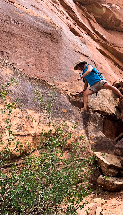 This is the drop at the end of the ledge you will need to navigate to get down from the ledge and back up on it after you visit the alcove
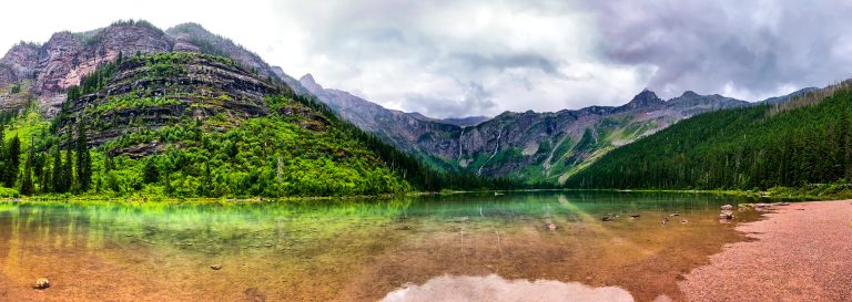
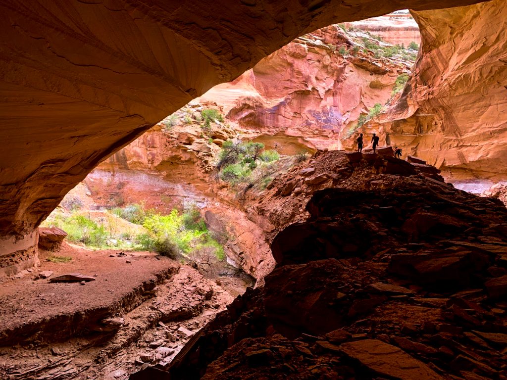
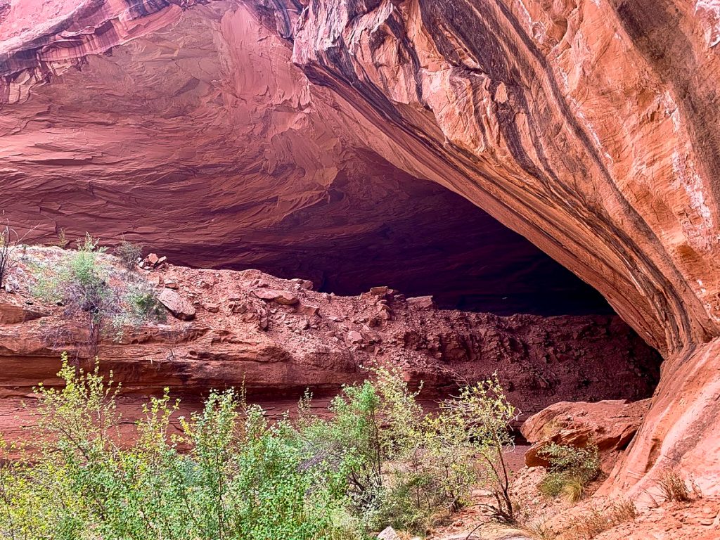
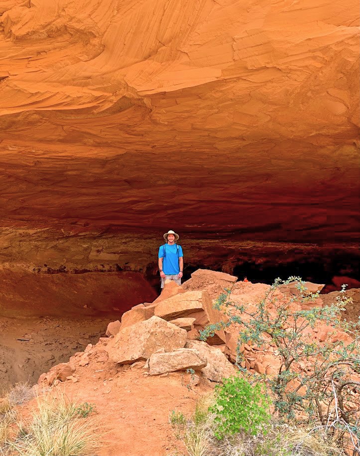
Once you reach the canyon floor, it is a little less than a half mile to the alcove. The alcove is very impressive. It is approximately 200 feet wide, 300 feet deep, and 80 feet high. I definitely recommend taking time to walk around the interior of the alcove and exploring prior to heading back up and out of the canyon. The views of the surrounding canyons on your way into and out of Mee Canyon are quite impressive as well. You cannot make out the arches at Rattlesnake Arches from this distance, but you can see their general area. This is another really amazing hike. If you are interested in hiking to the largest collection of arches outside of Arches National Park, you can read more about that hike on my blog post Rattlesnake Arches: Colorado’s answer to Arches National Park.
Getting There from Grand Junction, Colorado
Since Grand Junction is the closest city to Mee Canyon Alcove, these directions assume you are coming from Grand Junction. To reach the trailhead from Grand Junction, you navigate through the scenic Colorado National Monument before transitioning onto rugged backcountry roads. The drive will likely take about 1 hour and 30 minutes from town. This will depend on how quickly you are able to travel through Colorado National Monument and your experience driving rough dirt roads. A high clearance 4WD or AWD vehicle is needed for the final stretch of this route. This is only one possible route, so I also recommend checking your fastest route prior to going to the trailhead. I would also recommend downloading an offline map of the area as the BLM roads close to the canyon can be quite confusing the first time you are out there.
Driving Directions
- From downtown Grand Junction you will head to the South Entrance of Colorado National Monument: From downtown Grand Junction, take Broadway (Hwy 340) west. Turn left onto Monument Road and follow it to the South Entrance of Colorado National Monument.
- Pass through the entrance station and climb Rim Rock Drive. You will come to the Glade Park turn-off near the top of the initial climb.
- Turn left toward Glade Park on DS Road. Follow this road as it leaves the park and enters the Glade Park area.
- Continue on DS Road for several miles. You will eventually come to the historic Glade Park Store
- At the intersection with the store, turn right onto S. 16 1/2 Road. This road will eventually turn into N. 16 1/2 Road. Follow this road for approximately 4.6 miles until the intersection with Black Ridge Road.
- Turn left onto Black Ridge Road (BLM Rte 706) (look for the McInnis Canyons National Conservation Area signage). After approximately 1.1 miles, turn left onto Radio Tower Road (BLM Rte 707).
- From this point on, be sure to consult a map or GPS device with BLM roads shown. The directions you can acquire online tend to just say drive 13 miles on a dirt road after this point. There are marked BLM signposts along the way, but the last few miles to the trailhead are a bit confusing due to the large number of dirt roads in the area.
- Continue on to Black Ridge Upper Road.
- Turn left on BLM Rte. 707f. Follow BLM Rte. 707f until it merges with BLM Rte. 713G.
- Take BLM Rte. 713G to the trailhead.
- Depending on the season, there is some seasonality to these directions. Use the Upper Access Road from April 15 to August 15, and the Lower Access Road from August 15 to February 15.
- Again, it is best to use backcountry maps and GPS apps to help you reach this trailhead.
Travel Tips and Route Reminders
- Monument Fees: Since you are driving through Colorado National Monument, a park pass or entrance fee is required at the south entrance station.
- Vehicle Capability: The Roads after you turn onto Black Ridge Road can be very rough and rutted. The road becomes rockier and bumpier the closer you get to the trailhead. High clearance 4WD or AWD vehicles are absolutely recommended
- Inclement Weather: The BLM roads are clay-based soil roads that become impassable when wet. This clay becomes “grease-like” and dangerous. It will coat the tread on your tires and make it virtually impossible to control your vehicle. If there has been rain or snow recently, it is best to avoid the trip and to wait until there has been a long stretch of dry days.
- Wilderness Travel: The trail falls completely within a wilderness area, so be sure to adhere to all wilderness restrictions and regulations when hiking this trail. There is no water or cell service at the trailhead. Ensure you have a full tank of gas and plenty of water before leaving Grand Junction.
Staying in the area
There are numerous options for staying in the area before your hike. If you like disbursed camping, there are plenty of places to camp close to the trailhead on BLM lands. If you prefer camping in a campground, there is a large campground in Colorado National Monument. You can read more about this campground and find out about making reservations on the National Park Service website for camping in Colorado National Monument. If you prefer to stay in a hotel before or after your hike, there are great options available in both Grand Junction and Fruita. You can also check hotel availability for Grand Junction or Fruita below.