Silvershield Trail: Visit Dinosaur Tracks in Ouray, CO!
It is hard to believe that a town known as the “Switzerland of America” would have the longest known contiguous set of dinosaur tracks on earth until you see them with your own eyes. If you are looking for a unique hike that features an impressive collection of dinosaur tracks, Silvershield Trail in Ouray should be on your list. Be prepared though as the elevation gain and steepness of this hike will literally leave you breathless.
This post contains affiliate links. If you make a purchase through one of these links, I may receive compensation at no extra cost to you. Thank you for your support.
Hiking Silvershield Trail
There are multiple routes that you can take to access the Silvershield Trail dinosaur tracks. One is hiking in directly from the Silvershield Trailhead, and another begins along the Ouray Perimeter Trail before branching off on Oak Creek Trail and then Twin Peaks Trail. One other route involves hiking up the steep Old Twin Peaks Trail. I have not hiked the Old Twin Peaks Trail, so this article just focuses on the initial two routes.
From Silvershield Trailhead
Silvershield Trailhead is accessed just north of the town of Ouray. If you are coming from the north, exit Highway 50 onto CO Road 17. This is the road north of town with a bridge over the Uncompahgre River. You will then drive on CO Road 17 for roughly a mile before turning right onto Silver Shield Trail Road. The parking lot is a couple hundred feet from this turnoff. Try to arrive early as there is limited parking at the trailhead. Once you park, you might not be able to figure out where the trail is for a brief second. This is because the trail climbs nearly straight up along the cliff face in front of you.
If you have an activity tracker, you will continuously record flights of stairs goals as you hike. The initial climb gains almost 1,000 feet of elevation in less than a mile. Approximately, 0.7 miles into the hike, the incline becomes slightly less dramatic, giving your legs a well needed break. Approximately one mile into the hike, the grade becomes noticeably less even though you are still gaining altitude. The trail flattens out a lot as you approach the dinosaur tracks. If you just hike to the dinosaur tracks on this route, the hike is approximately four miles roundtrip.
I would suggest hiking a little bit past the dinosaur tracks as the views of Ouray just past the tracks are amazing. Even though the return hike is mostly downhill, it is still quite challenging. The path is very steep, and the eroded trail is very slippery. Trekking poles are definitely recommended to help you keep your balance and prevent you from slipping on the steep descent. You can view Silvershield Trail conditions and download GPS waypoints for the hike on Alltrails here.
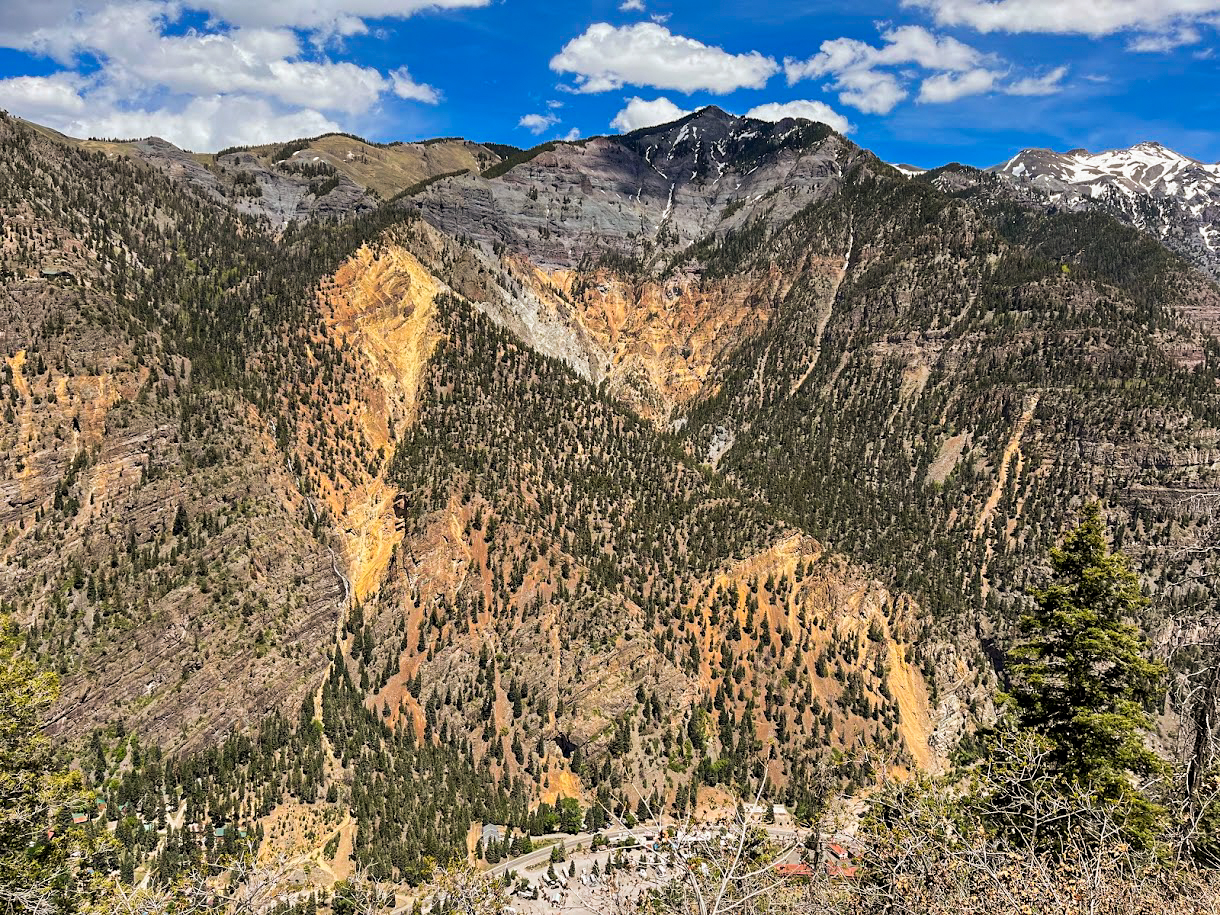 The hike up to the dinosaur tracks might be brutal, but the views are spectacular
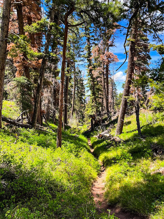 One of the “flat” stretches of trail that lets your legs relax slightly
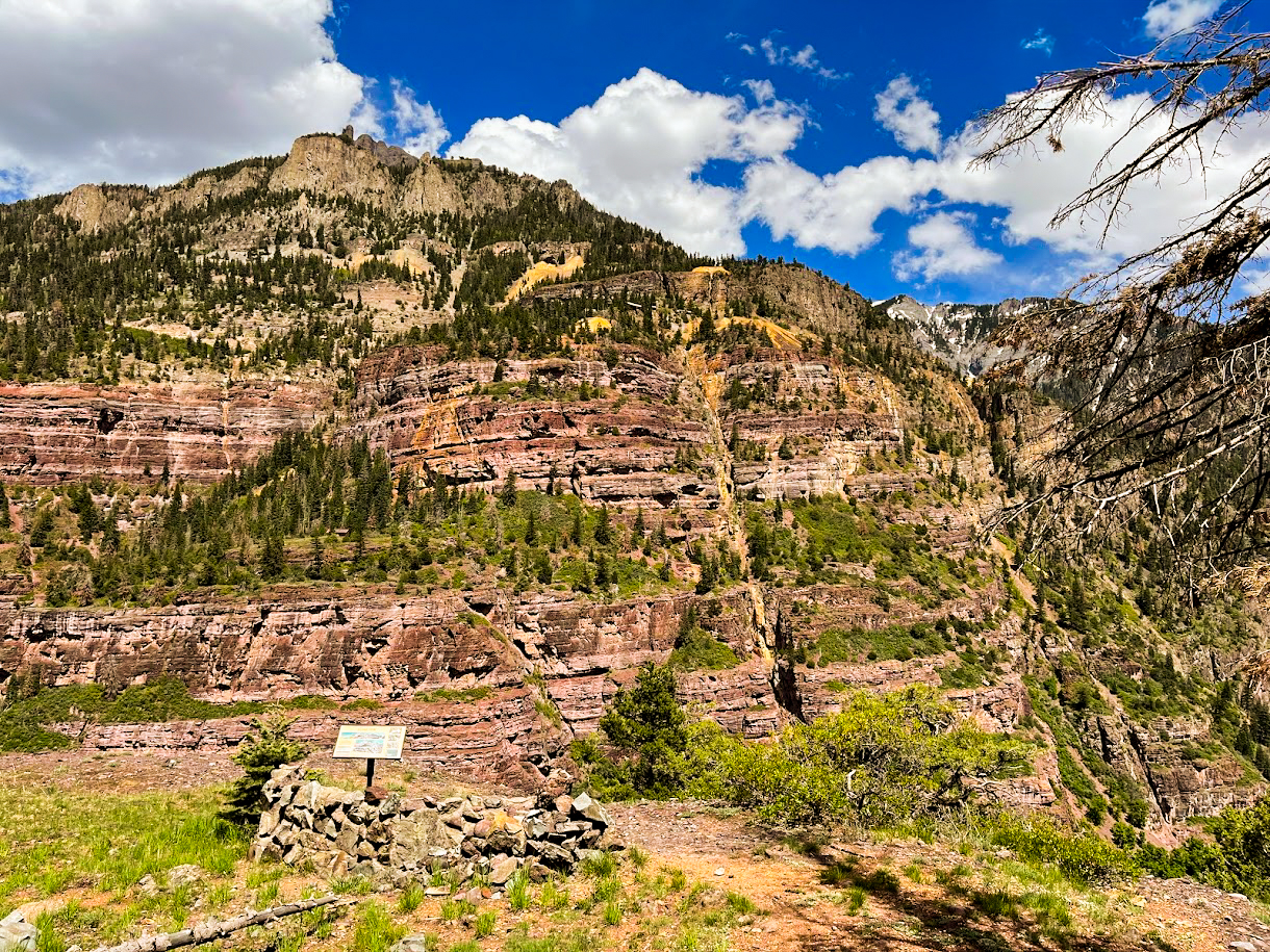 Be sure to read the signs in the area that highlight some of the mining history of Ouray
From the Ouray Perimeter Trail
If you want to hike to the dinosaur tracks from the Ouray Perimeter Trail, there are multiple ways to accomplish this. For the sake of brevity, I will just write about one of the most direct routes. This route begins at the intersection of the Ouray Perimeter Trail and the Oak Creek Trail. There are multiple routes to get to this intersection depending on where you park, so I’ll leave the beginning of the route to you. Once you get to the trail intersection of the Perimeter Trail and the Oak Creek Trail, follow Oak Creek Trail for approximately 0.8 miles until the trail intersects with the Twin Peaks Trail. Take Twin Peaks Trail for approximately 0.9 miles until it connects with Silvershield Trail.
At this junction, take Silvershield Trail approximately 0.2 miles to the dinosaur tracks. You can view this route on Alltrails here. This route is 3.77 miles with around 1,300 feet of elevation gain along the way. Keep in mind that the whole hike will be a bit longer depending on where you park and access the Perimeter Trail. There is a creek crossing where Twin Peaks Trail crosses Oak Creek, so wear waterproof footwear or plan to remove your shoes for this crossing if water levels are high. The trail is also fairly steep and eroded in some sections, so I also recommend taking trekking poles to help with the descent.
 The junction of the Ouray Perimeter Trail and Oak Creek Trail features one of my favorite overlooks of the town of Ouray
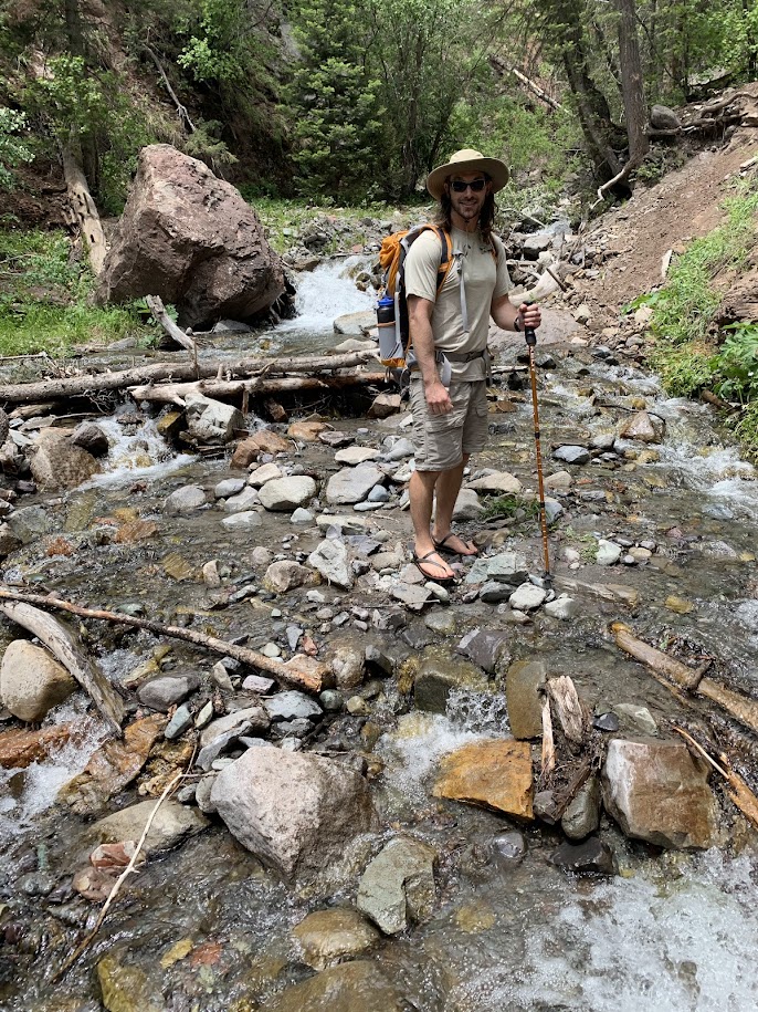 The creek crossing over Oak Creek can be a small trickle or a much greater flow of water depending on when you hike the trail
The Silvershield Trail Dinosaur Tracks
The tracks along the Silvershield Trail have officially been named the West Gold Hill Dinosaur Trackway. This trackway features the longest known contiguous set of dinosaur footprints in the world. The tracks are 106-yards long and consist of 134 consecutive footprints. These tracks were made by a longnecked dinosaur (sauropod) during the Late Jurassic period. These footprints are also rare because they feature the dinosaur making a 270-degree turn, which is the only known example in the world of a dinosaur making a turn greater than 180 degrees. You can read more about the significance of this site on the Smithsonian Magazine Website here or on the Ouray County Plaindealer Website here.
When I first hiked this trail, I did not know exactly where the dinosaur tracks were. I was concerned I might miss them and hike past them. It turns out that it is virtually impossible to miss 134 dinosaur footprints. They stand out immediately as you approach this stretch of the trail. If you are not intimidated by a very steep trail with a lot of elevation gain, you should definitely visit this site. Seeing dinosaur footprints at 9,300 feet is something you will remember forever. This is especially true considering it is currently the longest known set of tracks in the world.
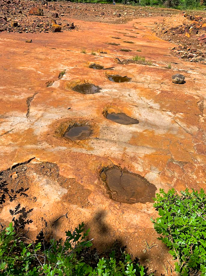 The dinosaur trackway if virtually impossible to miss as it stands out so much from the surrounding landscape
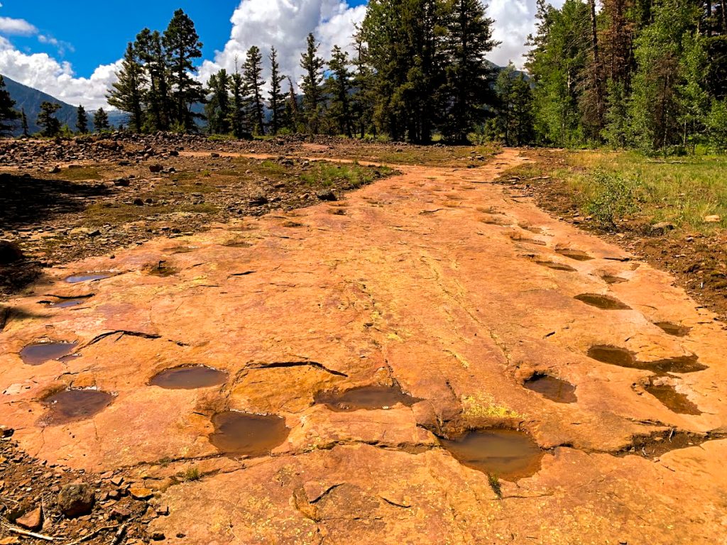 The section of trail where the sauropod made its 270-degree turn
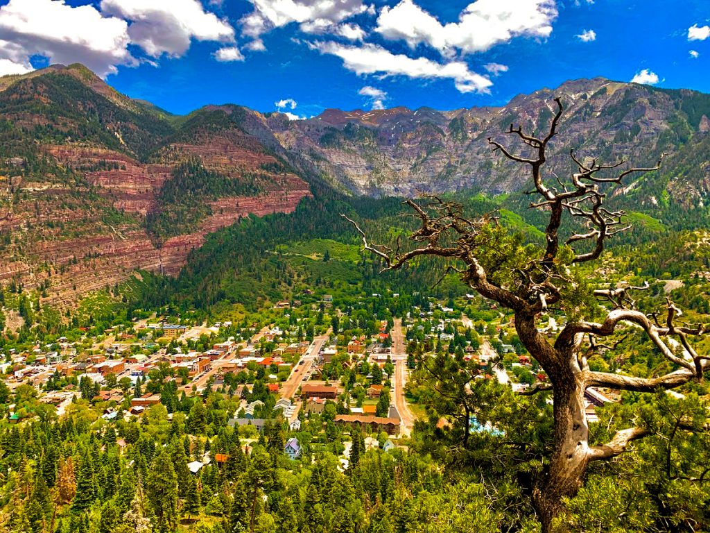
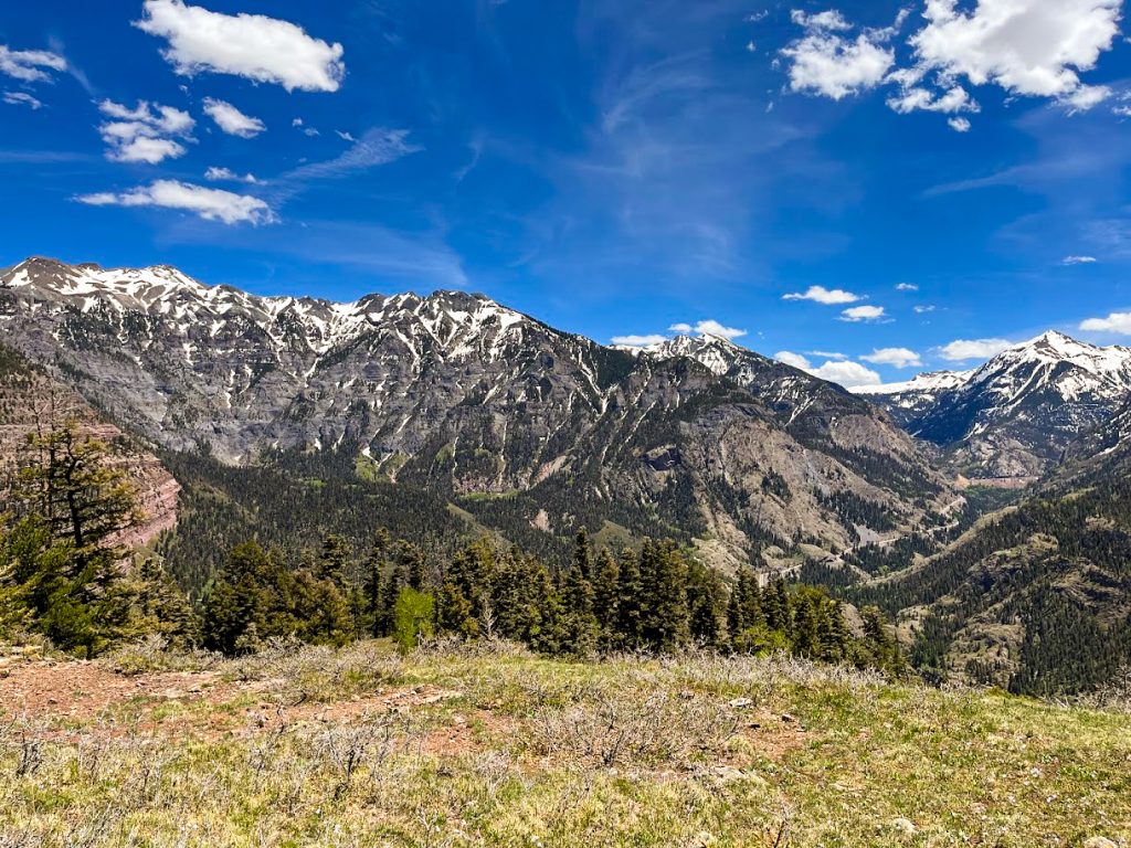 Views of Ouray and the amphitheater Rock Formation just past the dinosaur trackway are also worth the hike
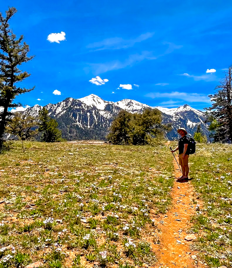 There is at least one flat stretch of trail between the dinosaur trackway and the amazing overlook of Ouray
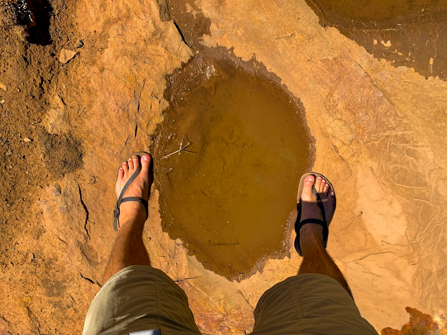 My feet compared to one of the sauropod’s footprints
If You Visit Ouray:
If you are looking to stay in this area and are not camping at a campground or disbursed camping, Ouray offers many hotel options. You can view some of the top places to stay in Ouray here. If you are stay in Ouray, you should also check out The Wiesbaden Hot Springs Spa and Lodging for secluded hot springs and a vapor cave where you can relax and rejuvenate after your hike. You can read more about the features of the Wiesbaden in my article here.